|
|
Post by David Sechrest on Sept 24, 2009 18:34:21 GMT -5
It is unknown where this picture was taken. It's a good depiction of life in the 1800's. From the Robert Dennis collection. 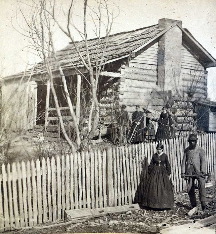 |
|
|
|
Post by David Sechrest on Sept 24, 2009 18:41:51 GMT -5
This picture was taken in the Dining Room of the Soldier's Home in Marion Indiana. From the Robert Dennis collection. 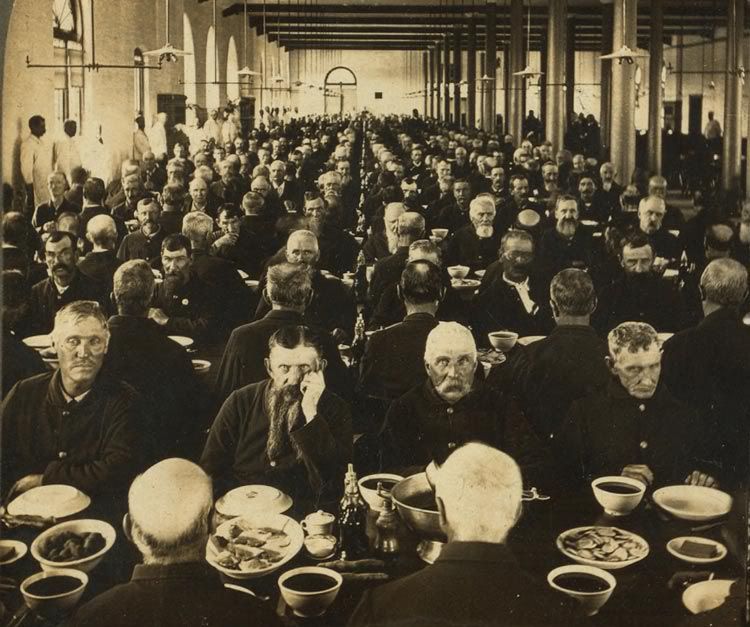 |
|
|
|
Post by David Sechrest on Sept 24, 2009 19:21:26 GMT -5
A typical Indiana farm in the late 1800's...From the Robert Dennis collection. 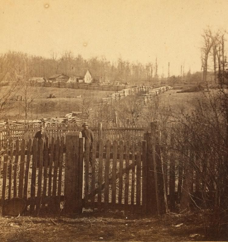 |
|
|
|
Post by David Sechrest on Sept 24, 2009 19:28:29 GMT -5
Lightning Express. From the Robert Dennis collection. 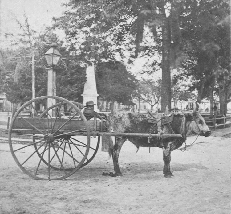 |
|
|
|
Post by David Sechrest on Sept 24, 2009 19:37:56 GMT -5
Rural farm, late 1800's, from the Robert Dennis collection 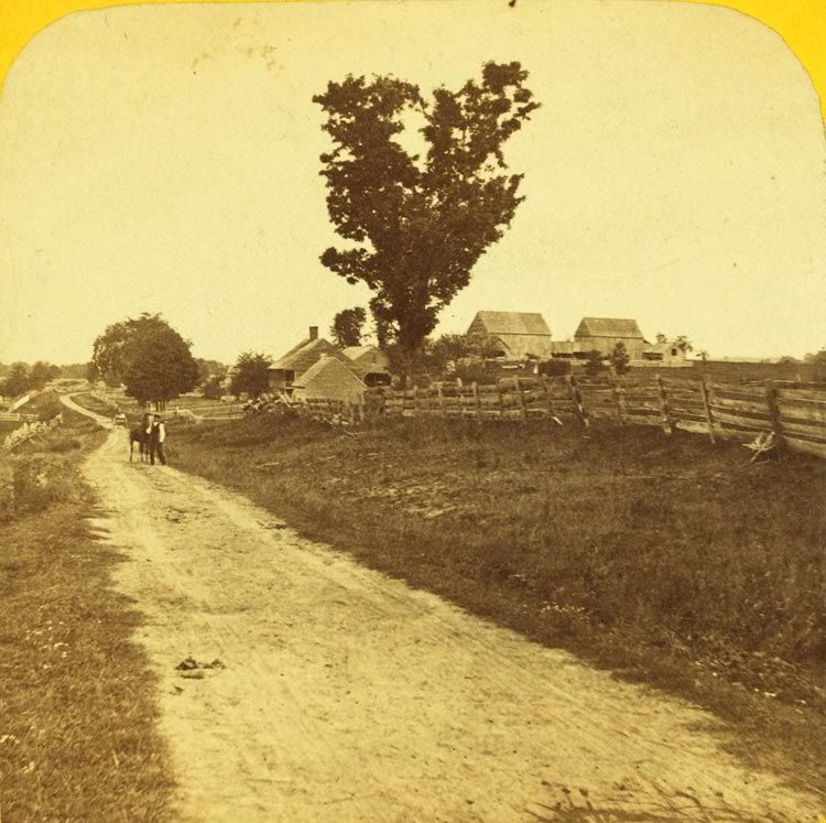 |
|
|
|
Post by David Sechrest on Sept 24, 2009 19:43:19 GMT -5
Somewhere In Indiana... 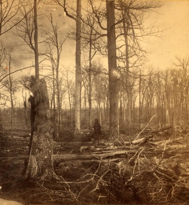 |
|
RER
HCI Forum Board Member
"Democracy & Freedom"
Posts: 2,462 
|
Post by RER on Sept 25, 2009 19:01:12 GMT -5
Further Confirmation That All The Columbus Pictures Were Taken between 1872 and 1874Comment: This post will relate to the four pictures that have been under discussion for the past few weeks. The pictures of course have been determined to be some of the earliest photos of Columbus. The point of my opinion will be based on what Jason, David and others have contributed to the analysis of the scenes.  Pharmacy Symbol Clue (corner of 301 Washington St.) Pharmacy Symbol Clue (corner of 301 Washington St.)We all know the Bartholomew County Courthouse was in two separate pictures of the group. One was showing the courthouse with incomplete window frames, windows, and the clock. Historically, the construction wasn't finished until 1874. The clock was completely installed 1874. Now, the second picture showed a view going West down 3rd Street to the Tipton Mound home of Mr. Schwartzkopf. To the right of that picture view is a blown up view of the corner of Washington Street, the Schwartzkopf (assumed) saloon, and a barbershop poll of the past designs. Now, the third picture revealed the group of ladies possibly protesting the Schwartzkopf liquor saloon. The Schwartzkopf sign is shown and the early barber pole. The new clue is the Pharmacy symbol at the corner of Washington Street next to the future history address of 301 Washington Street. This is where Jason's history of that address ties into what I am guessing here. The next partial picture with colored circles highlights the discussion. The below left circle is the barbershop pole, the oval sign the saloon, and lastly the right circle is the corner of the various drug stores as summarized by Jason's in part quotes below. It is now clear to me, that the pictures related even too the drug store history dates, plus the unfinished courthouse dates.  Pharmacy stir/container symbol (far right circle) Jason' summary said: "The town of Columbus was 27 years old when, in 1848, brothers Aquilla and Benjamin F. Jones built the first building on the present 301 Washington Street site. Since that time, the $3,000 three-story brick building, has undergone many changes and has been occupied by numerous tenants. In the early 1850's, Dr. H. T. Hinman began a drug store in the corner room of the "Old Jones' Corner." Also Said: "While Storey's drug store occupied the "Old Jones' Corner," a number of businesses and offices came and went. William McEwen and B. F. Jones, who now owned the property, set up a dry goods store in their building. Above their store, George M. Gilbert, a fashionable tailor had his shop. In November, 1858, McEwen and Jones sold the property to Joseph Ireland Irwin and Francis P. Smith, who moved their dry goods business into the room formerly occupied by McEwen and Jones. A year later, J. I. Irwin, retaining his interest in the property, sold his interest in the dry goods business to F. P. Smith, and went into the dry goods business on his own at 327 Washington Street. About that same time, A. C. Downey and A. W. Prather began a joint law practice in one of the rooms upstairs; Prather continued his practice in that office for better than 15 years. Francis P. Smith, on the other hand, served as a representative to the State Legislature from Columbus in 1861 and 1862. In 1863 his interest in the property was sold by the sheriff to John V. Storey. Some of the businesses and offices in Storey and Irwin's building around 1865-66 were: the Provost Marshall's Office, Third District - Captain James B. Mulkey, who was also an attorney, and Lieutenant Thomas C. Wilson; G, W. Richardson, attorney; Schloss and Samuels, dry goods, merchant tailors and dealers in clothing; also, John V. Storey, wholesale and retail druggist. The year 1872 brought several more changes in tenants. Mrs. Amanda E. Williams, milliner and dress maker, set up her shop in the building. Richard Carter and John Mahoney had their grocery and provisions store in the room north of the drug store on the Washington Street side. Then, in December, James A. Smith bought the drug store from John V. Storey. By late 1877 Carter and Mahoney had moved out of the building, and Mrs. W. D. Summers, a milliner, had taken their store and five of the rooms upstairs as an apartment for her three children and her assistant. On November 15, 1877, a fire broke out in Mrs. Summers' store, a scant month after she had moved in. The fire destroyed $1,200 worth of her stock and furniture in her apartment. Some of J. A. Smith's stock was also damaged. Mrs. Summers moved into Mrs. Williams' old stand until the rooms could be repaired. The drug store again changed ownership in 1879 - T. B. Harlan bought the store and stock from J. A. Smith - and the following year, Clarence W. Adams bought it from T. B. Harlan. In early May of 1881 Adams moved his drug store to 322 Washington Street, as Joseph Irwin had bought out Storey's interest in the property and had decided to renovate the building and use it for his bank and store." _________________________________ My conclusion: That all the pictures were taken at the same date and time. I would say 1872 to 1874, not later because the clock was installed in the courthouse in 1874. I could be wrong, but close. ______________________ Appreciation: Thanks to Richard, David and Jason for clearing up the pictures and to Jason for all the dates of the corner of 301 Washington Street. Wow, it took me a hour to post this and make my typo and error corrections. Thanks to David I got the clock date changed.
|
|
|
|
Post by David Sechrest on Sept 25, 2009 19:27:40 GMT -5
nancs, I've been meaning to thank you for the lead to the info regarding A. Tross.
There's so much on this Message Board that sometimes I forget...
Thanks again
|
|
RER
HCI Forum Board Member
"Democracy & Freedom"
Posts: 2,462 
|
Post by RER on Sept 25, 2009 19:48:06 GMT -5
Here Is The Pharmacy Drug Store Clue At 301 Washington Street With The LadiesThe colored oval circle shows the Pharmacy symbol and a sign that almost says "Drug Store." This would have been on the historical corner of 3rd and Washington Street per my last post.   Richard's Black & White Defined Richard's Black & White DefinedThe last few letters on the sign says: "ug Store." The top of the Pharmacy Drug store shows the stir bowl (partial) and stir stick out of the top. _________________________ Appreciation: To Richard for the black & white defined photo so you can read "ug Store."
|
|
RER
HCI Forum Board Member
"Democracy & Freedom"
Posts: 2,462 
|
Post by RER on Oct 16, 2009 19:33:22 GMT -5
School House Development & Teacher Qualifications From 1821 through 1834
Bartholomew County Indiana
Bartholomew County was organized in 1821. At that time the county was given 7 thousand acres of land for school house development. However, at that time the county was mostly a forest of trees everywhere. As the early pioneers cleared the trees and land for cabins and farms, it was apparent there was a steady increase of children. Each settlement or township built log cabin school houses as the development continued.
The state of Indiana owned approximately 600 thousand acres of school land, but lacked the money to build houses and hire teachers. Then in 1834 a law was passed, relative to building and maintaining the school houses statewide. The law dictated the “order” to build the necessary school houses, and that every “able bodied man” in the districts was required to work one day a week to assist in building the houses, or pay the sum of thirty-seven & one-half cents ($ .37 ½ ) for everyday the man failed to work the projects. The standard of construction included this statement:
“Constructed or finished in a manner to render comfortable surroundings for the teacher and pupils”.
The districts and townships employed a tax collection to maintain the schools expenses such as teacher employment. The qualified teacher was paid $10 to $12 per month and boarded among the patron families of the schools. The 1831 statute (law) required the teacher to teach Reading, Writing, and Arithmetic. It was difficult to find qualified applicants to teach English Grammar and the 3 Rs (reading, writing & arithmetic). This year of 1831 law was the creation of the old saying of the “3 Rs”.
Keep In Mind: Columbus was not an official city until 1830, or one year before the 3 Rs law was enacted.
|
|
|
|
Post by David Sechrest on Oct 27, 2009 1:11:09 GMT -5
 I've taken somewhat of a different approach to the pictures we've been discussing. I posted this stereoscopy image on a Railfan message board, hoping that the engine might be identified. The general consensus so far is they believe the engine is basically a work engine. Used only around the yard. This is only speculation, but the box car to the left of the engine may be American Express. This may just make sense, as Columbus did have an American Express office. When that office first opened, I do not know, but I do recall seeing an AE office on a Sanborn map or the map in the 1879 Atlas. Also, the time period we've been talking about here seems right: 1860's-1870's. The coal car is JM&I. I'm still hoping for someone who may be familiar with the types of uniforms worn by engineers and conductors of the period. One stated the uniforms do look "around" the time of the civil war.
|
|
|
|
Post by David Sechrest on Oct 27, 2009 1:23:29 GMT -5
Also, it just might be that this picture was taken at the JM&I Freight Depot. Refer to the 1886 Sanborn map. There's a JM&I Freight Depot on the east side of Brown, north of 5th Street. That area is nothing but a big mess of railroad tracks and I'm wondering if Brown even passed through 5th and 6th Sts. It looks like it does, but what a slew of track here.
If you look at the picture of the engine, you can see 4 tracks, including the one the engine is sitting on. The tracks and depot on the 1886 map is laid out very similar.
|
|
|
|
Post by David Sechrest on Oct 27, 2009 14:42:12 GMT -5
Here's the layout from the 1886 Sanborn map: 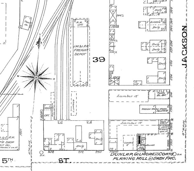 |
|
|
|
Post by David Sechrest on Oct 27, 2009 14:49:59 GMT -5
The other thing about the engine picture is the tender is loaded with wood and not coal.
|
|
RER
HCI Forum Board Member
"Democracy & Freedom"
Posts: 2,462 
|
Post by RER on Oct 27, 2009 17:10:08 GMT -5
Ref: David's comments about the 1870s pictured train and the Sanborn 1886 Map showing railing tracks. Brief: I think you are correct about the small wood fired steam engine train being a "work engine" for use around the main yard areas or depot layouts. Also, after viewing the old 1886 map you posted, it does appear to be 4 tracks that would have been around the Jackson & 5th Streets during the 1870s. Tracks as we know in those days didn't change much, but were expanded in different directions. The tracks didn't cross Washington and 5th Streets during that time period per the map you presented. Those must have been installed around the time of the first Cerealine and mills at corner of 5th and Franklin, plus the other lumber and coal yards later near 3rd street. However, these tracks may have been North of the pictured Map (not shown) on another Sanborn Map. The train in the picture does not have the so called "cow catcher" grill in the front, which further confirms that one wasn't needed in the yard area moving box cars and the like. See the two pictures below and the cow catcher grill from another normal cross country type train.  "Cow Catcher" Grill (front "Cow Catcher" Grill (front)  No Grill "Cow Catch" (has small metal bar) No Grill "Cow Catch" (has small metal bar)
|
|
|
|
Post by David Sechrest on Oct 27, 2009 19:09:23 GMT -5
Bob, the tracks did cross Washington Street. They are cropped out of the area in question on the 1886 Sanborn map.
|
|
RER
HCI Forum Board Member
"Democracy & Freedom"
Posts: 2,462 
|
Post by RER on Oct 27, 2009 20:17:41 GMT -5
Thanks David and I was not sure but thought they did without further research.
|
|
RER
HCI Forum Board Member
"Democracy & Freedom"
Posts: 2,462 
|
Post by RER on Oct 30, 2009 20:38:27 GMT -5
Columbus Indiana Map Dated 1876Horse & Buggy DaysBartholomew County  Before Clock Was InstalledComments: Before Clock Was InstalledComments: Over the past few weeks we have discussed many times the very old pictures that were dated in the last part of the 1870s. The local Republic newspaper ran a front page story of the discovery of the pictures and had an inside page also of some of the pictures. The County Courthouse was under construction; the Tipton Mound House was in the background and the women in protest by a local liquor bar. The County Courthouse clock was installed this year the map was printed. Below is a detailed map of Columbus dated 1876 of the same time period. You will note that Columbus was very small and only had about twelve streets from North to South. The city line was before you crossed Hawcreek going East and the City Line was drawn before you crossed White River and Flatrock River. The map recognizes the Bartholomew County Courthouse structure as well as the former jail house. Tipton Mound is further shown and the main City School about the same area of the old Columbus High School now torn down. The railroad tracks can be seen, plus the toll bridge across White River into what is know today as the Garden City area. Lastly, you will note the old street names of the past before renaming some that you utilize today. All streets were dirt. 
|
|
|
|
Post by Ricky_Berkey on Oct 31, 2009 13:12:29 GMT -5
Notice as well to the left in what is now the Mill Race Park area can be seen the actual Mill Race running through the area that the park was named for. I don't believe there is any trace of that Mill Race still there. Many people have asked me why it was named Mill Race Park. Columbus Indiana Map Dated 1876The map recognizes the Bartholomew County Courthouse structure as well as the former jail house. Tipton Mound is further shown and the main City School about the same area of the old Columbus High School now torn down. The railroad tracks can be seen, plus the toll bridge across White River into what is know today as the Garden City area. Lastly, you will note the old street names of the past before renaming some that you utilize today. All streets were dirt. |
|
RER
HCI Forum Board Member
"Democracy & Freedom"
Posts: 2,462 
|
Post by RER on Nov 1, 2009 18:22:06 GMT -5
This is a repeat post related to Columbus Theaters, because it relates to the 1800s life in Columbus Indiana[/b][/u] This Is another Amazing Discovery Of Columbus Indiana History (134 Years Ago)The Dedication Program Of The Pallas Theater During 1875Located In The St. Denis Hotel Corner of 5th & Washington StreetColumbus, Indiana  Pallas Theater Inside St. Denis Hotel (see Ricky Berkey's note @ bottom)Comment: Pallas Theater Inside St. Denis Hotel (see Ricky Berkey's note @ bottom)Comment: This is the same time period the Bartholomew County Courthouse was being built. The courthouse clock still had not been installed. This is the "horse and buggy" days and Mr. J. G. Schwartzkopf's beginning his fine opera adventures. They include some owners of Cerealine and other Columbus businessmen of 1875. Honorable: J. G. Schwartzkopf (Tipton Mound Home Owner)Event After Program: A Grand Ball followed immediately after the program.The Program Follows (3 pages):    Historical Comment By Ricky Berkey Historical Comment By Ricky Berkey: According to vol 2 of the Bartholomew County History Book, the theater in the St Denis building was very upscale and called the "Pallas Theater". According to that account it burned in a fire earlier than the one in 1894 that started in the livery. The theater was never rebuilt after that first fire.
|
|